Quick answer: Wind strips away the thin layer of warm air your skin holds against it, so your hands lose heat far faster than the thermometer alone suggests — a 15°F day with 30 mph wind cools exposed skin at roughly the same rate as -5°F with no wind at all. Hands are hit harder than almost any other body part because they have a lot of surface area relative to their volume and sit at the very end of your circulation, the first place your body cuts blood flow to protect your core.
If you’re gearing up for genuinely windy conditions, the Ski Glove Finder helps match glove construction to how much wind exposure you’re actually planning for.
The rest of this covers what’s actually happening physically, why altitude changes the math, how your body tries to fight back on its own, and what genuinely helps versus what only feels like it does.
- What Wind Chill Actually Measures
- Why Wind Speed Changes the Equation More Than Temperature Does
- Why Hands Take the Hit First
- Your Body's Own Backup System — and Its Limits
- What Specific Conditions Actually Mean for Your Hands
- Altitude Makes the Math Worse in a Few Real Ways
- What Genuinely Blocks Wind and What Doesn't
- Mistakes That Make Wind Chill Worse Than It Needs to Be
- Recognizing When Conditions Have Become Genuinely Dangerous
- A Simple Self-Check for Your Current Gloves
- A Practical Way to Plan Around It
- Frequently Asked Questions
What Wind Chill Actually Measures
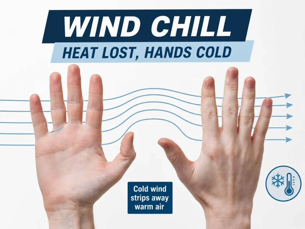
Wind chill isn’t a real temperature — it’s a calculated stand-in for how fast your skin loses heat, expressed as the calm-air temperature that would produce the same cooling rate. Your skin naturally warms a thin boundary layer of air right against it, and that layer acts as a bit of extra insulation on its own. Wind physically strips that layer away and replaces it with fresh cold air before your skin can rewarm it, over and over.
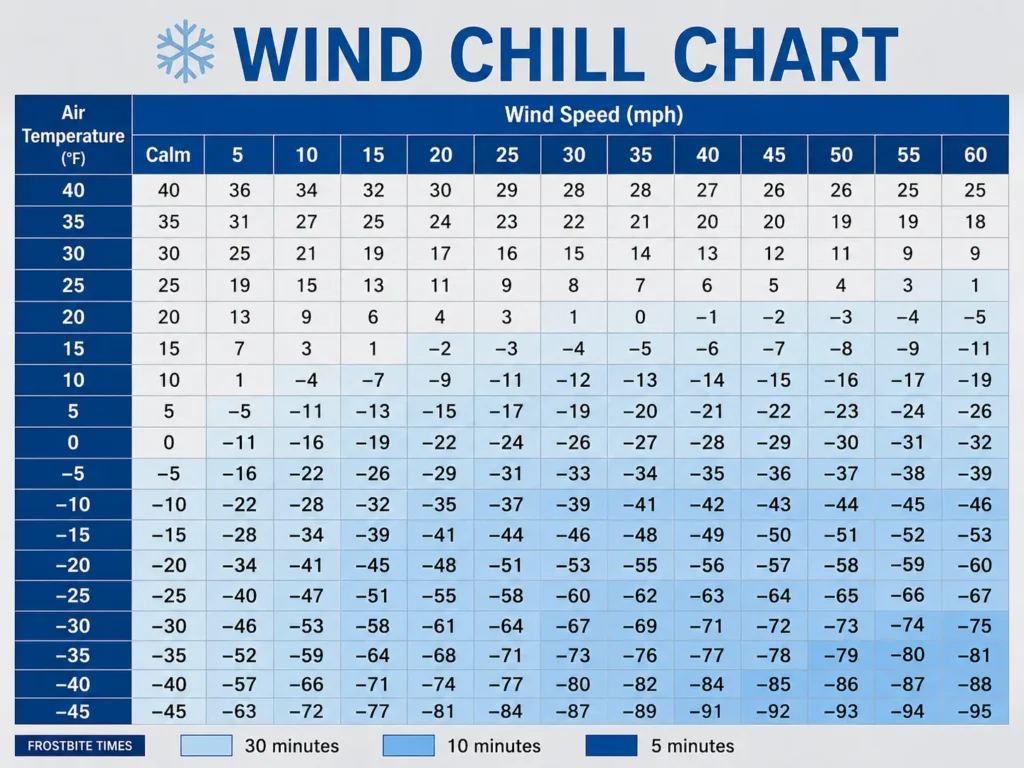
The National Weather Service’s own wind chill formula reflects exactly this effect — at 0°F with a 15 mph wind, the calculated wind chill drops to roughly -19°F, and exposed skin can freeze in that range within about 10 to 30 minutes, a dramatically shorter window than the same 0°F would produce with no wind at all.
The formula only applies below 50°F and above roughly 3 mph of wind, which covers the overwhelming majority of a real ski day, and it’s worth knowing that the underlying formula was derived from actual human trials measuring skin cooling rates rather than a rough estimate — the specific numbers it produces are grounded in measured physiology, not a marketing approximation.
Why Wind Speed Changes the Equation More Than Temperature Does
The relationship between wind speed and heat loss isn’t linear — it climbs fastest at lower wind speeds and levels off somewhat at higher ones, which is why the jump from calm air to even a light breeze does more damage to your comfort than the jump from a moderate breeze to a genuinely strong gust.
This is also why two very different temperature-and-wind combinations can produce identical risk. A cold, still morning and a milder but genuinely windy afternoon can land at the same effective wind chill, even though one sounds far more dangerous on the thermometer. Checking wind speed specifically, not just the forecasted air temperature, is the only way to actually know what your hands are about to experience.
This nonlinear relationship also explains why a forecast showing “10 mph winds” and one showing “25 mph winds” don’t just differ by a proportional amount in how they feel — the jump from light to moderate wind removes a disproportionately large share of your skin’s protective boundary layer, while further increases beyond that point add danger more gradually. A skier checking wind speed only to see if it’s “windy or not” misses this — the difference between 5 mph and 15 mph matters more to your hands than the difference between 25 mph and 35 mph does, even though both represent the same 10 mph jump on paper.
Why Hands Take the Hit First
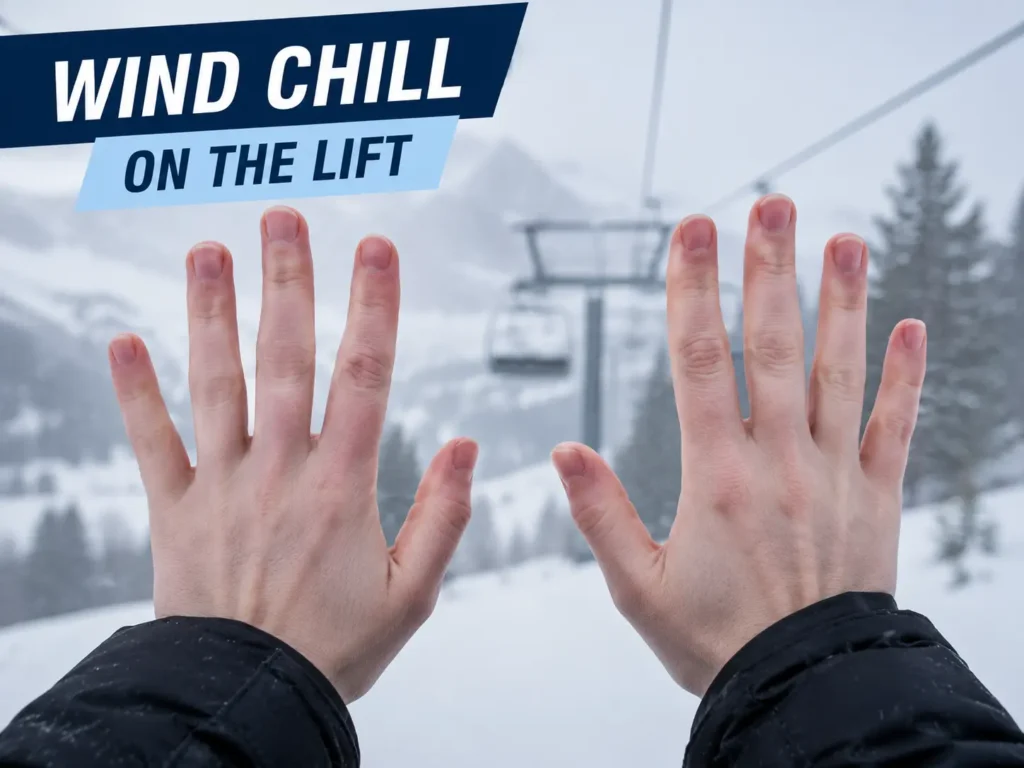
Hands lose heat faster than almost any other part of your body for a straightforward physical reason: they have a large amount of skin surface relative to how much tissue volume that skin covers, especially in the fingers. More exposed surface per unit of mass means more area for wind to pull heat from, and less internal mass to keep replenishing it.
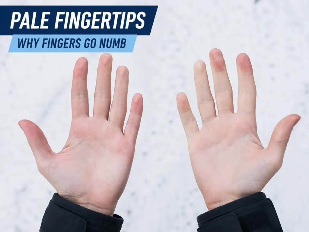
On top of that geometry, hands sit at the functional end of your circulatory system. When your body senses a real cold threat, it prioritizes keeping your core organs warm over your extremities, and hands are among the first places blood flow gets restricted to make that trade. That combination — thin, high-surface-area tissue that’s also first in line for reduced blood flow — is exactly why fingers go numb well before your torso or thighs notice the same conditions.
Your Body’s Own Backup System — and Its Limits
Hands aren’t entirely defenseless once blood flow starts dropping. A genuine physiological response called cold-induced vasodilation, sometimes called the hunting reaction, kicks in during sustained cold exposure — roughly eight minutes into sustained finger cooling, blood vessels in the fingers cyclically reopen in bursts, sending brief pulses of warm blood back through before constricting again, a pattern that repeats throughout continued exposure and is thought to help protect against frostbite while partially preserving dexterity.
This response is real, but it’s not a substitute for adequate gear. It’s a stopgap that buys time and reduces injury risk during cold exposure your gloves should already be handling — not a mechanism that makes underdressed hands safe in serious wind chill. Relying on it instead of appropriate gloves is a mistake, not a strategy.
What Specific Conditions Actually Mean for Your Hands
Numbers help more than general warnings here, since “windy and cold” covers a huge range of actual risk.
| Air Temp | Wind Speed | Effective Wind Chill | What It Means |
| 30°F | 15 mph | ~19°F | Mild — standard gloves handle this fine |
| 20°F | 20 mph | ~4°F | Moderate — a sealed cuff starts to matter |
| 10°F | 25 mph | ~-15°F | Serious — wind-blocking shell essential, limit exposed-lift time |
| 0°F | 20 mph | ~-22°F | High risk — frostbite possible in 30 minutes or less on exposed skin |
| -10°F | 25 mph | ~-38°F | Severe — minimize any skin exposure, short exposure windows only |
The jump between the second and third rows is the one most skiers underestimate — a 10-degree air temperature drop combined with a moderate wind increase pushes conditions from “sealed cuffs help” to “wind-blocking shell is no longer optional,” a bigger practical shift than the raw temperature numbers alone would suggest.
Altitude Makes the Math Worse in a Few Real Ways
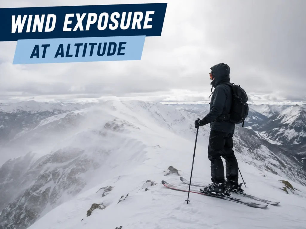
High-elevation skiing compounds wind chill risk through a few compounding factors rather than one dramatic physics shift. Mountain summits and exposed ridgelines are simply windier on average than sheltered valleys, so the wind-speed half of the wind chill equation tends to run higher at altitude regardless of the air temperature reading. Base-area thermometers also routinely read several degrees warmer than what you’ll actually face 2,000 vertical feet higher, so the temperature you checked before leaving the lodge is rarely the temperature at the summit.
Skiing speed itself adds a wind chill factor most people never account for. Moving through still air at 25 to 30 mph — an easy cruising pace on an intermediate run — generates the same wind exposure as standing still in a 25 to 30 mph gale, on top of whatever the ambient wind is already doing. A calm-looking day can still produce meaningful wind chill purely from how fast you’re moving through it.
What Genuinely Blocks Wind and What Doesn’t
A tightly woven or membrane-backed shell fabric stops wind mechanically, by simply not letting air pass through the material — this is the single most reliable protection against wind chill specifically, more than raw insulation thickness alone. A thick but loosely woven glove can still let wind punch straight through and strip warmth the same way a thin one does.
Gaps are the other half of the equation, and they’re easy to overlook. Wind doesn’t need a large opening — a loose wrist cuff, a gap where a jacket sleeve rides up, or worn elastic that no longer seals fully all give wind a direct path to skin that the rest of the glove is otherwise protecting well. Sealing the cuff-to-sleeve interface matters as much as the glove’s own material choice.
What doesn’t fully work: activity and movement generate real heat, but they don’t override wind’s ability to strip it away just as fast, especially at the fingertips where circulation is already limited. Sun exposure helps at the margins on a clear day but does essentially nothing once wind speed climbs into genuinely dangerous territory. Neither is a substitute for wind-blocking material and a sealed cuff — both are, at best, a small buffer on top of adequate gear.
Mistakes That Make Wind Chill Worse Than It Needs to Be
Checking only the air temperature before a ski day, without glancing at forecasted wind speed, is the single most common planning mistake — two days with the same reported temperature can present wildly different actual risk to your hands depending on wind alone.
Assuming a glove that performed fine on a calm cold day will perform the same way on a windy one leads people to underdress for conditions their gear was never tested against by the wearer. A glove that’s plenty warm in still air can leave hands genuinely cold once wind starts pulling that boundary layer away, even at the same air temperature.
Leaving a wrist gap unsealed — jacket sleeve riding up, cuff not cinched, loose elastic — undoes a well-built glove’s wind resistance from a single small opening. It’s a five-second fix that gets skipped constantly simply because it’s easy to forget once you’re already moving.
Pushing through persistent numbness rather than taking a warm-up break, especially on an exposed lift or ridge, is the mistake most likely to turn ordinary cold discomfort into an actual injury. The relatively small time cost of a break is easy to underestimate against the actual risk of continued exposure once numbness has stopped resolving on its own.
Recognizing When Conditions Have Become Genuinely Dangerous
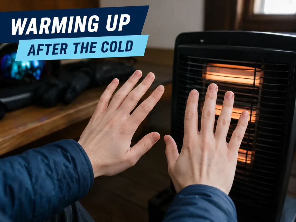
Early numbness that resolves once you’re back in a warm space or moving your fingers is uncomfortable but not yet an emergency. Frostbite risk becomes real once skin shows persistent redness or pain that doesn’t ease, or takes on a white, grayish, or waxy appearance — signs that circulation in that tissue has dropped low enough for actual freezing risk rather than ordinary cold discomfort, and frostbitten skin is frequently painless specifically because the affected area has already gone numb, which is part of why people miss it until someone else notices.
The practical rule that follows from this: numbness that eases with movement or a warm-up break is normal cold-weather discomfort. Numbness that persists, or skin that changes color, means it’s time to get off the mountain and warm up properly, not push through one more run.
A Simple Self-Check for Your Current Gloves
A quick way to test whether your gloves actually block wind, rather than just feeling warm indoors, is holding the back of the glove up to a fan or a genuinely breezy spot outside and feeling for airflow through the fabric against the back of your hand. Material that lets you feel moving air, even faintly, through the shell will underperform in real wind chill regardless of how thick or warm it feels in a still room.
Check the cuff separately by closing it fully and gently working your wrist back and forth the way you would while skiing. If the closure loosens or gaps open with normal movement, that’s the specific failure point that lets wind in on the mountain even if the glove tested wind-tight while sitting still.
A Practical Way to Plan Around It
Check wind speed specifically before a genuinely cold day, not just the air temperature — a forecast showing 20°F and calm is a very different day for your hands than 20°F with sustained 25 mph gusts, even though both show the same number on a basic weather app.
Weight ridge lines, exposed chairlifts, and summit terrain more heavily in your planning than base-area conditions, since that’s consistently where the worst combination of higher wind speed and lower actual temperature shows up. A mild morning at the base doesn’t guarantee a mild ride up an exposed lift.
Build in warm-up breaks proactively on genuinely windy days rather than waiting for numbness to force the decision — by the time hands feel seriously cold on a high wind chill day, you’re already well into the exposure window that matters, and a planned break costs you far less than reacting to a real problem.
If your current gloves consistently leave your hands cold specifically on windy days rather than every cold day, that’s a useful diagnostic on its own — it points toward a wind-blocking gap in your gear rather than a general insulation shortfall, and wind-blocking options across price points are worth more than simply buying a warmer-rated glove that still lets wind straight through.
Frequently Asked Questions
Does wind chill actually make the air colder, or just feel colder?
Neither, exactly — the air temperature itself doesn’t change, but wind chill describes a real physical effect: your skin loses heat faster in wind than the thermometer reading alone would suggest, which has genuine consequences for frostbite risk even though the air itself hasn’t gotten colder.
Can gloves fully eliminate wind chill risk?
Not entirely in extreme conditions, but a properly wind-blocking shell with a sealed wrist closure removes most of the risk that inadequate gloves create. The remaining risk in genuinely severe wind chill comes down to exposure duration more than gear quality at that point.
Why do my hands get cold on the chairlift but feel fine while actively skiing?
Sitting still on an exposed lift combines reduced heat generation from inactivity with continued, often stronger, wind exposure — the opposite of active skiing, where movement generates heat even as speed adds its own wind chill component. Lift rides are consistently the highest-risk window in an average ski day.
Is there a wind chill threshold where I should just stay inside?
There’s no universal number, since glove quality, activity level, and individual cold tolerance all shift where that line actually falls, but wind chill in the range where frostbite risk drops to 10 minutes or less on exposed skin is a reasonable point to limit exposure time regardless of how good your gear is.
Does skiing speed really add meaningful wind chill on a calm day?
Yes — moving at typical intermediate-run speeds generates wind exposure roughly equivalent to standing still in the same wind speed, which is why hands can feel genuinely cold on an objectively calm, sunny day the moment you’re actually skiing rather than standing at the base.
Do liner gloves help specifically with wind chill, or just general cold?
Mostly general cold, not wind specifically — a liner adds trapped air and insulation value, but it doesn’t block moving air the way a wind-resistant shell does. A liner under a shell that already stops wind is genuinely additive; a liner under a shell that doesn’t block wind is still losing heat to the same mechanism, just slightly more slowly.
Wind chill isn’t a mysterious multiplier working against otherwise-adequate gear — it’s a specific, physical mechanism that rewards wind-blocking material and a sealed cuff far more than it rewards raw insulation thickness alone. Understanding which of your gear choices actually addresses that mechanism, rather than just feeling warm in a parking lot, is what separates hands that hold up on an exposed ridge from hands that don’t. If numbness keeps showing up despite gear that seems adequate on paper, numb finger causes cover the fit, circulation, and moisture factors that sit alongside wind as contributing causes.